Dixie-QEW, Microtunnelling, Surveying

Featured Project: Microtunnel alignment surveys, Dixie-QEW Storm Sewer

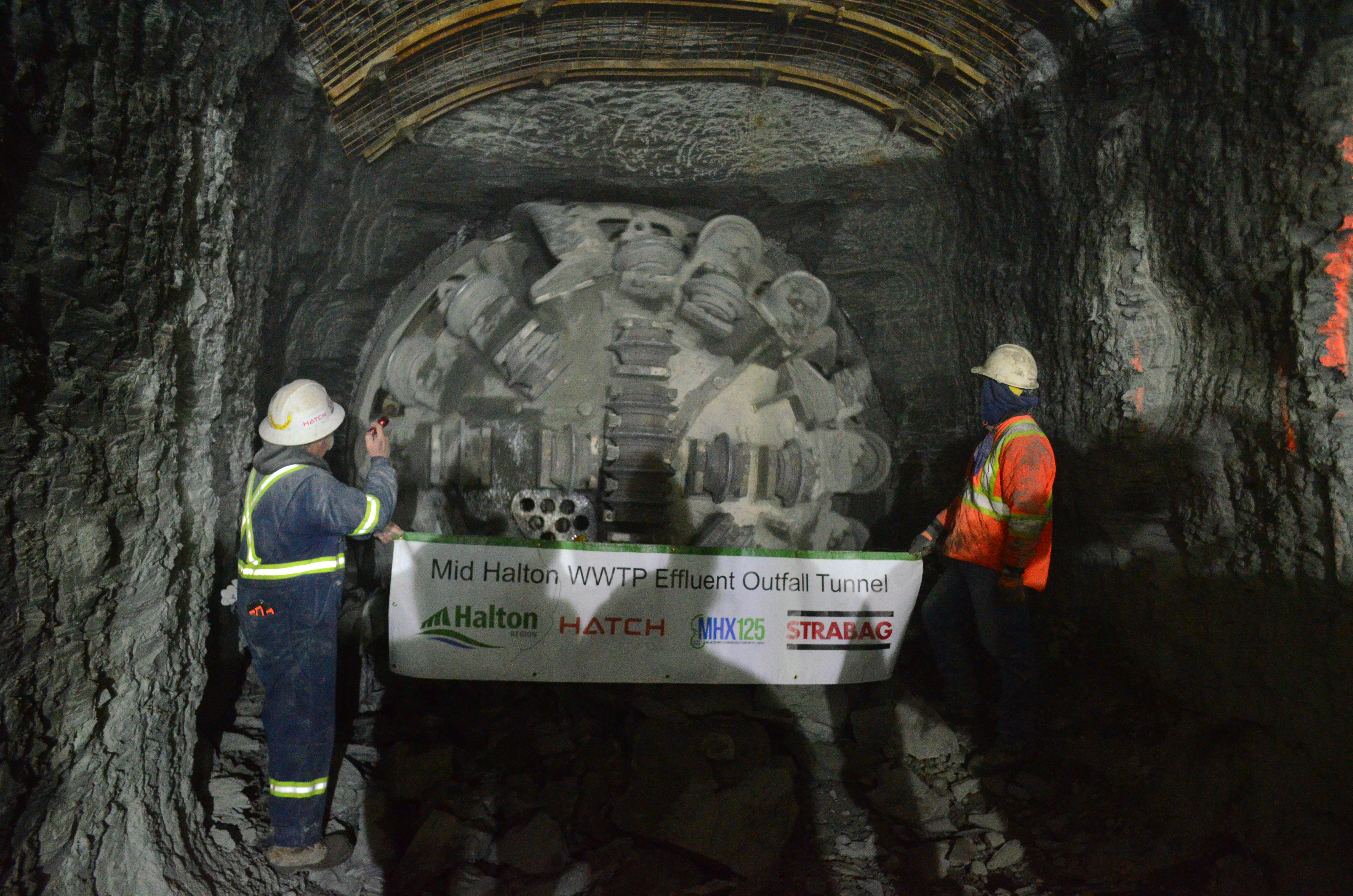
Monteith & Sutherland crews work with CRS Tunnelling Canada project team to ensure the microtunnelling of the 1200mm storm sewer at Dixie-QEW is going per design alignment.

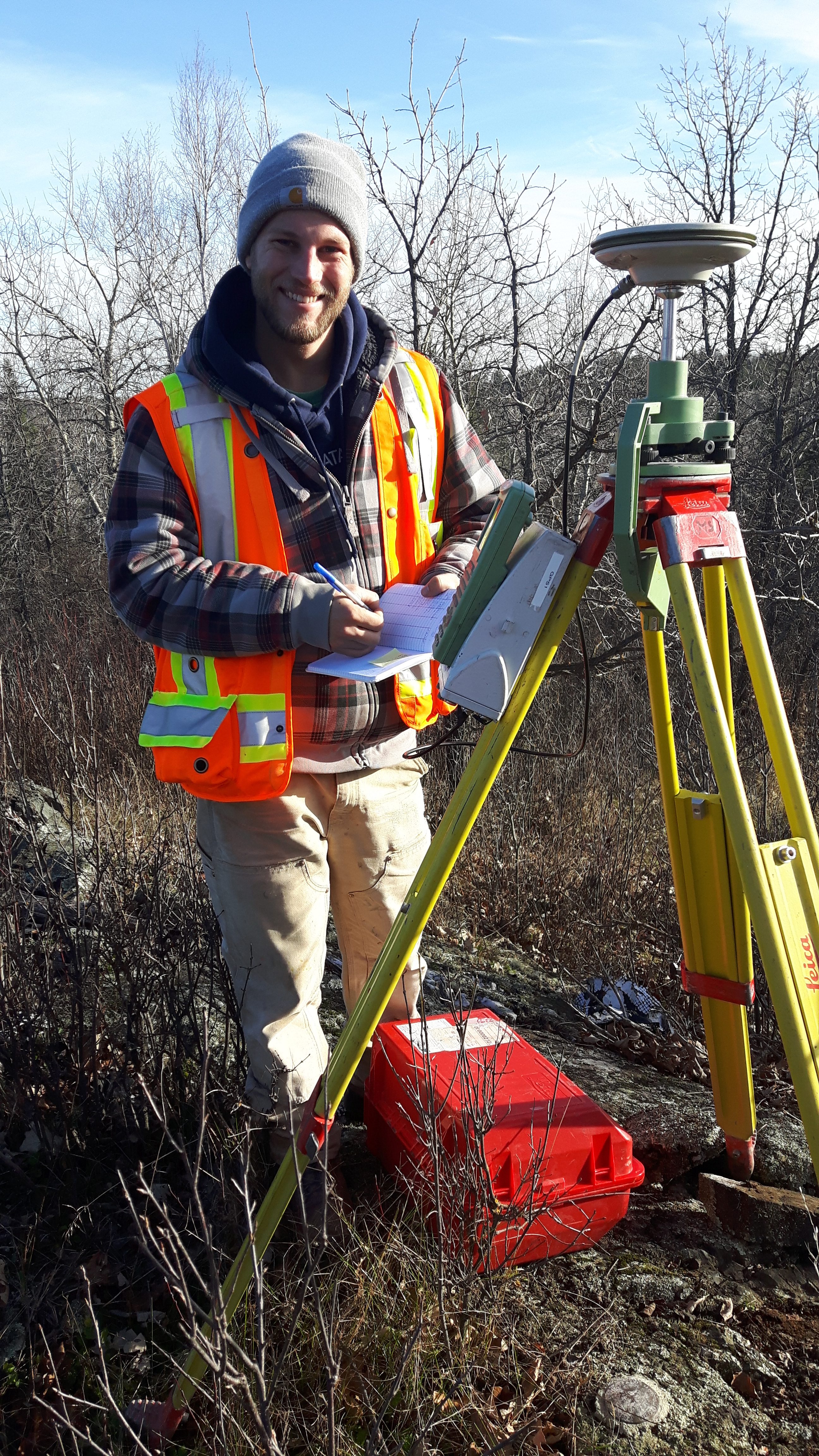
Precise traversing, while crawling, bending and crouching, and carrying the survey equipment all the way to the heading in and back to the portal is a very demanding task. Our crews do an outstanding job, delivering excellent surveys data sets, and performing all tasks in a safe manner.

Hamilton Barton St Overflow HDL Pointcloud Snapshot

Featured Project: Pre-rehabilitation HDLS survey of overflow sewer

Last month Monteith & Sutherland have teamed-up with PipeFlo and performed pre-rehabilitation high definition laser scanning (HDLS) survey of overflow sewer at Barton Street between Weir St North and Fairfield.

The survey was completed with P40 Leica HDL scanner. The data were processed in Leica Cyclone, and cross-sections at 1 metre interval, along with best fit centreline of the structure, were generated in 3D Reshaper:

Hamilton Barton Overflow HDLS Cross-sections

Thanks PipeFlo for the highest safety practices pertaining the confined space entry, and for all the help during the survey.


February Featured Project: Rapid Static GNSS Campaign

Task Overview: Rapid Static GNSS Campaign:

Technician Mark Paddey (pictured above) is documenting survey station parameters and diagramming the vicinity and any obstructions. Monteith & Sutherland established 16 control monuments along a 10km stretch of Highway 600. We used a classical static survey technique to establish our control values over such a large area. The rapid static GNSS technique using our Leica GNSS 1200 receivers can provide accuracies to the order of 1:5,000,000. Using our equipment, the accuracy expectations for horizontal coordinates are 3mm + 0.5ppm and vertical coordinates are 6mm + 0.5ppm, which are unmatchable over large distances with other survey techniques. Mark worked in conjunction with 3 to 4 other staff who established other receivers. Data is recorded on all receivers simultaneously at the same data rate, typically 5 seconds. Observation time for the rapid static campaigns are based on the length between the occupied points and also based on the number of available satellites. At least 4 satellites are required to resolve Latitude, Longitude, Height, and Receiver Time Offset. For this project, we completed two initial 2-hour baseline campaigns followed by shorter observation times on successive campaigns measuring each new point. This allowed us to properly complete the data reduction and post-processing of the satellite data and publish accurate coordinate for these new control monuments.


Complete Geospatial Solutions

Complete Geospatial Solutions

From the design of complex geodetic networks through control surveys, gyroscopic verifications, monitoring, hydrographic surveying, detailed topo and HDL Scanning to UAV mapping, at Monteith & Sutherland we have expert personnel and precise equipment to provide trusted results. Monteith & Sutherland: Complete Geospatial Solutions.


ECLRT Tunnel Surveying

Tunnel surveying | ECLRT Project

Monteith & Sutherland have been proud partners of Metrolinx, and provide high precision survey services in challenging conditions. In this particular project – performing differential levelling, total station traverses, gyroscopic verification surveys, and High Definition Laser Scanning for our client.

ECLRT Bayview Monitoring

ECLRT Deformation monitoring at Bayview intersection

On the Eglinton Crosstown Light Rail Transit project we perform precise deformation monitoring, where we survey surface and building settlement points. There are approximately 4250 settlement instruments to be observed at varying frequencies over the course of the project, with 7 survey crews working together to complete daily monitoring tasks where there is active construction. One of the most challenging parts of this work is the traffic management. We work alongside On Track Safety Ltd and Toronto Police to manage the flow and safety of traffic, as well as the workers.

Mid Halton Outfall Tunnel

Mid Halton WWTP Effluent Outfall Tunnel Breakthrough

Congratulations to the entire STRABAG team working on the Mid Halton WWTP Effluent Outfall Tunnel.

Yet another accurate and precise breakthrough was made, notably due to tremendous efforts of the project tunnel surveying crew.

At Monteith & Sutherland we are happy to have had contributed to this success by performing numerous gyroscopic surveys, using GYROMAT3000 in order to verify the correctness of the complex underground traverse network spanning over 4 kilometers.

Spot on!

DSC_0443

DSC_0403

***All images are courtesy of STRABAG Canada***


ECLRT Deformation Monitoring

On the Eglinton Crosstown Light Rail Transit project we perform precise deformation monitoring, where we survey surface and building settlement points. There are approximately 4250 settlement instruments to be observed over the course of the project, with 6 survey crews working together to complete daily monitoring tasks where there is active construction. One of the most challenging aspects of this monitoring project is measuring above the Tunnel Boring Machines at night and combating poor lighting and glare from car headlights. See below for a glimpse at the process: